Tara Jeffrey
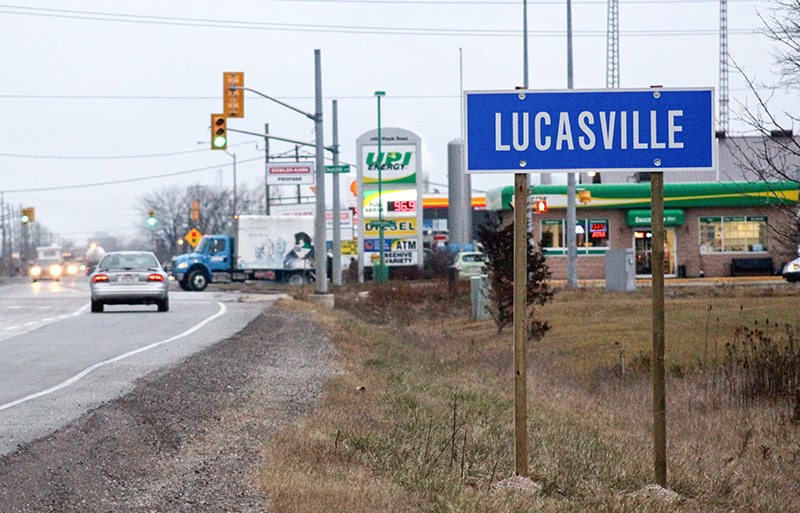
A series of new signs popping up in Sarnia may have caused some motorist to do a double take.
“I’ve had a few calls come in,” city planning manager Kevin Edwards said, referencing the Lucasville signage recently posted near what’s commonly called the ‘Beehive’ intersection.
The long-lost hamlet, located on Plank Road, near Churchill Road and Kimball Sideroad, is still listed as a point of reference in Ontario’s official Geographic Feature and Place Names Database, Edwards explained.
“The province requires the county and city to erect identification signs that correspond with their Official Road Map of Ontario,” he said. “If it’s on the map, it has to have a sign.”
City officials consulted Heritage Committee members, who agreed Lucasville should remain on the map, noting its rich history as a stop on the Plank Road -- a primary route from the oil fields to Sarnia.
A historical sketch prepared by city officials says the hamlet was named after George Lucas, who came to Sarnia in 1845 and bought several parcels of land. In 1862, the Plank Road was extended through his property at Churchill and Kimball in Sarnia Township to form a six-point intersection.
The community was initially called Cole’s Corners after the Cole family who operated a cheese factory there into the 1880’s.
Lucas became the first postmaster in 1875, and both the hamlet and post office were changed to Lucasville by 1888 when the office was moved to his Lucas hotel.
Lucas eventually moved into Sarnia where he was elected to town council. He died in 1895 and is buried in Lakeview cemetery.
“I once saw a reference to Lucasville as home to the four ‘tions,’” said local historian and author Bob McCarthy. “Cultivation, damnation, education and salvation.
“Apparently, standing at the crossroads, you could turn a circle and see a farm, a saloon, a school and a church.”
The hamlet grew but the Lucas hotel suffered a setback when Sarnia Township voted dry in 1904, and was closed with the post office in 1911.
The Lucasville Methodist Church closed in 1931 and was converted to a service station known as the ‘Beehive.’ The building was eventually demolished but the nickname stuck. The six-point ‘beehive’ intersection itself was eliminated in 1965 when Lucasville Road (the sideroad north to the Dual Highway now 402) and Churchill Road to the west were incorporated into the Sarnia Bypass and redesignated Highway 40.
New village signs have also been posted to identify Bright’s Grove and Mandaumin, Edwards added.
“Over time, places like Florence and Shetland will have to be signed as well.”
Sources: Jean Trumbell Elford, Canada West’s Last Frontier: A History of Lambton; J.H. Beers & Co., Commemorative Biographical Record of the County of Lambton; In re Lucas vs. McGlashan, Queen’s Bench and Practice Court Reports (1844-1882)
