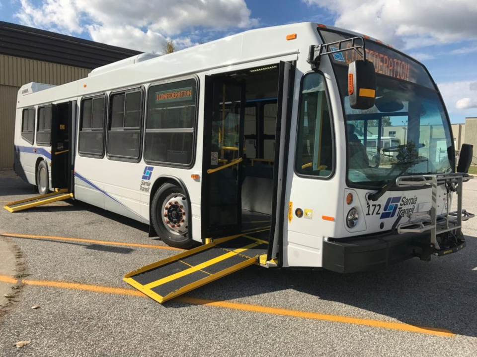
The City of Sarnia is inviting residents to provide feedback through its newly launched Sarnia Transit Rider Survey, which seeks to gather insights into how the local public transit system can be improved based on the needs and experiences of its users.
In The Transit Ridership Recipe, transit consultant Jarrett Walker presents strategies for increasing ridership, emphasizing the challenge of balancing high ridership with broad coverage and the crucial role of frequency in effective transit. Walker identifies four key factors for effectively identifying potential for high ridership transit. In a previous article, Density and walkability were covered. This article focuses on the remaining two: linearity and proximity. These factors are explored in the context of Sarnia’s transit network.
Linearity
In the image below, two towns are identical except for the arrangement of four development centers. In the first town, the centers are in a straight line, making a single transit line efficient and direct. In the second town, a single line connecting all four centers is unnecessarily circuitous, making it far less appealing for travel between non-adjacent centers. Walker noted that a ridership-maximizing transit agency would avoid such designs and prioritize locations “on the way” between other destinations.
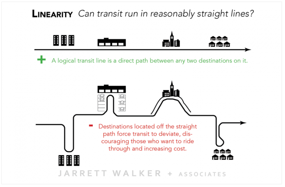
In Sarnia, East-West corridors such as Exmouth St., London Rd., Wellington St., Devine St., and Confederation St. create a linear connection between higher-density housing and mixed-use areas in the city’s southwest and southeast, linking them to various destinations along the way. Similarly, North-South corridors like Christina St., Mitton St., East St., Indian Rd., and the Quinn Drive/Lambton Mall Rd./Finch Drive corridor provide easy connections between people and key places.
Proximity
In the image below, two towns are identical except for the distance between the main residential areas. Walker explains that if a transit budget is the same in the two towns, the second town will likely have less frequent or shorter-duration service. This is because resources are spread over more route miles, reducing frequency and potentially lowering ridership.
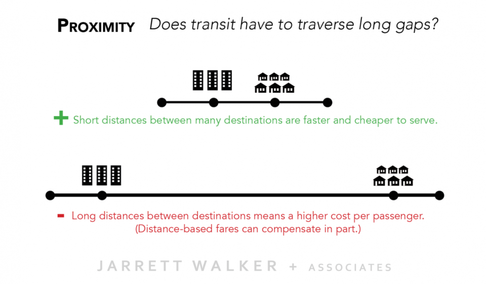
Sarnia's transit network, as shown below, is similar to town 2 in the examples above, connecting some key destinations through long, circuitous routes that pass through low-density areas with few destinations.
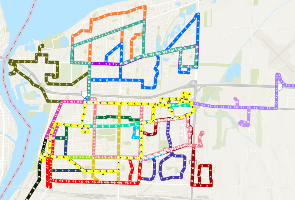
The current network does not provide frequent, direct, or efficient transit coverage within or between the Strategic Growth Areas outlined in the City’s Official Plan. These areas include Mitton Village, Downtown, Northgate, and the Quinn Drive/Lambton Mall/Lambton College regions.
Additionally, transit coverage along key growth corridors, including Exmouth St., Indian Rd (south of 402), Wellington St., Devine St., and Confederation St., does not currently support high-frequency service.
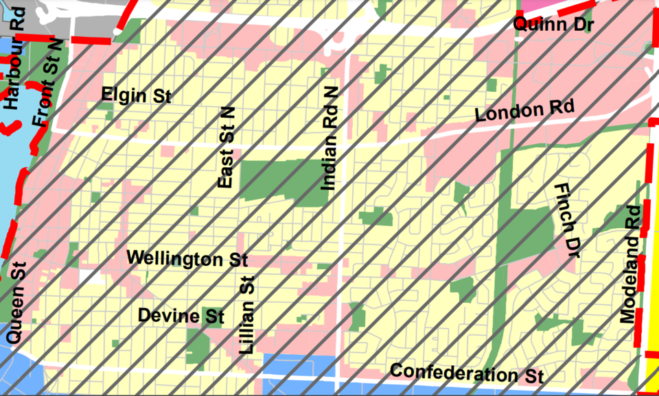
Walker suggests that designs such as Sarnia's current Transit network may discourage ridership and increase costs per passenger.
Walker clarifies that neighbourhoods resembling the second town in these examples are not being criticized, nor is it suggested they should not have transit. The goal is to explain how transit is designed to maximize ridership.
To achieve high ridership, transit should focus on areas with density, walkability, linearity, and proximity. Walker suggests that ridership and service potential are lower in areas lacking these characteristics. Similar to businesses, he notes that transit agencies prioritize areas with favourable conditions.
For Sarnia, following these suggestions would mean improving connections between people and places in the southwest and southeast of the city, which aligns with the Strategic Growth Areas outlined in the Official Plan.
Ultimately, the desired level of ridership is a decision for the community.
How to Share Your Thoughts:
The Sarnia Transit Rider Survey is open until 4 p.m. on December 20, and residents are encouraged to participate to help shape the future of the city’s transit system.
