Troy Shantz & George Mathewson
If Sarnia spends millions protecting its Lake Huron shoreline, will that include a disputed stretch claimed as private property by Bright’s Grove landowners?
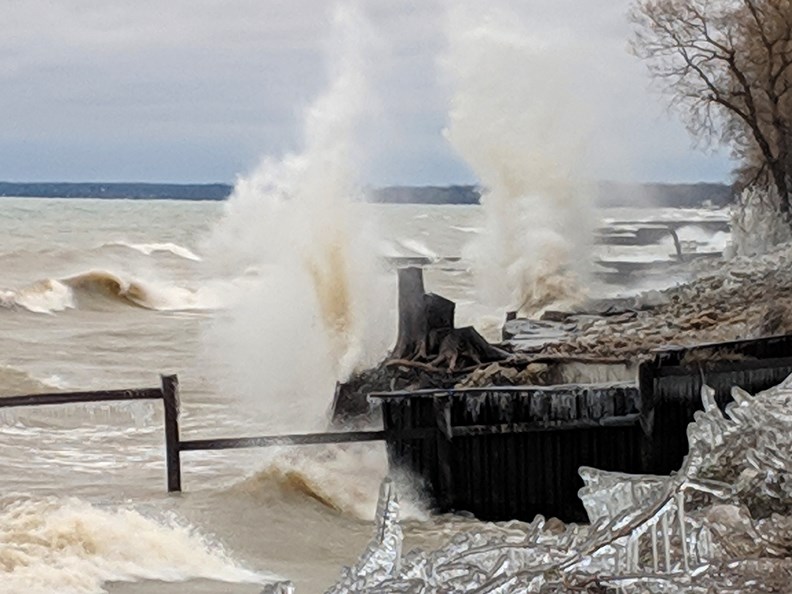
Known as the “lost beach,” the half-mile of prime waterfront between Perch Creek and Mike Weir Park contains a 66-foot right-of-way that once followed Old Lakeshore Road, before sections of road were washed out be a storm in 1973.
Since then, many of the two dozen property owner who live there have built decks, boathouses and seawalls on the public right-of-way.
“It’s a very difficult area,” said Sarnia construction manager Rob Williams. “It has been encroached upon (and) generally speaking it has not been accessed by the public for many years,” he said.
“But we do believe that it’s ours. It’s Old Lakeshore Road. Old Lakeshore Road was never given away.”
City staff, who have mused about creating a public trail on the right-of-way and linking it with waterfront trails to the east and west, estimate protecting that section of shoreline could cost $8.8 million.
But there is some urgency. Parts of the right-of-way are now in the lake because of ongoing erosion, and in one place just 24 of the 66 feet remains on land.
Some landowners insist the allowance is private. One, Dan Lambert, told The Journal last year his family has owned it for generations and isn’t conceding it belongs to anyone else.
“I have deeds that go back to 1919,” he said.
Another complication is the absence of a bridge over Perch Creek (Cull Drain), which limits public access to the beach.
Williams said the $8.8 million covers only the cost of shoreline protection. A footbridge and path would be extra, as would money for any legal challenges.
Give all that, the Perch Creek-to-Weir Park stretch will be a low priority until more frequently used sections are protected, Williams said.
The proposed work involves revetments and groynes.
A revetment is a sloped, stone armouring of the shore; groynes are structures built perpendicular to the shore, extending about 30 metres into the water.
Both shoreline fortifications would be built with armour stone at a cost of roughly $7,500 per linear metre, Williams said in a report to council.
Bright’s Grove resident Mark Andrews runs a 400-member Facebook group called Save the Old Lakeshore Right of Way, a grassroots effort to return the land to the public and establish a footpath through it.
He said some homeowners concede the city owns the road allowance and are hopeful of shoreline repairs.
“This might be a good opportunity for the city to show whether they’re going to do anything with this right-of-way or not,” he said.