George Mathewson
Score one for Lake Huron.
A breach in the seawall between Telfer and Brigden sideroads has grown alarmingly since The Journal described the state of Sarnia’s shaky shoreline defences earlier this year.
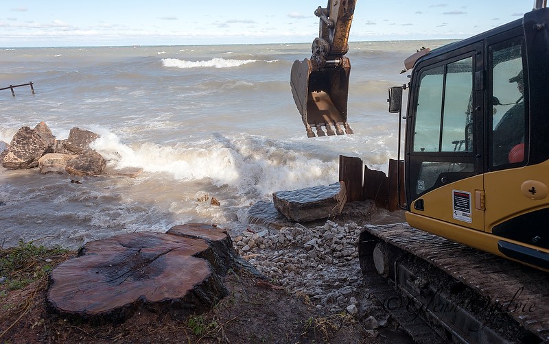
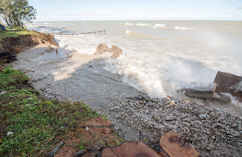
The lake has ripped out 100 feet of rusty steel wall just east of the Cull Drain, scoured out more than 1,300 cubic metres of ground and caused large willow trees to topple into the water.
Heavy equipment and crews from Van Bree Drainage & Bulldozing worked frantically last week to seal the breach from pummeling waves and reinforce another 180 feet of failing seawall with loads of rock on either side of the washout.
A new city engineering report contains grim news:
* An estimated 3,000 tonnes of shoreline was washed away and even the quick fix could cost $250,000.
* Getting the necessary approvals and finding money to build a more permanent revetment out of armour stone will take a year or more.
* And what’s happening at the Cull Drain isn’t a one-off. The Bright’s Grove shoreline has many other areas in disrepair and at risk of failure.
In other words, more of Sarnia’s shoreline could be wiped out in the next big storm.
How did we reach this point?
To be fair, Sarnia and the St. Clair Region Conservation Authority have already installed the solid armour stone protection in parts of The Grove.
But 15 years of near-record low water levels created, along with those wide beaches, a false sense of security. Now, the lake has risen 10 inches more in just the past year.
The washout also raises an interesting legal question that has implications for both private waterfront landowners and the rest of us who like to visit the beach.
Much of the property that fronts the lake in that area is in public hands, part of a right-of-way from the old Lakeshore Road, which itself was washed away in the 1970s.
If waves continue to eat inward beyond the width of the public land, “the backshore owner may become the new waterfront owner and the City may lose the waterfront access,” warns a new report prepared by Shoreplan Engineering Limited.
The seawall failure at the Cull Drain is just north of the Jameson Farm, at 2229 Lakeshore Road.
Ironically, the Jameson family has for decades been extremely gracious in allowing public access to the waterfront via a footpath that crosses their property.
If seawalls up and down the coast continue to fail, the issue of who owns what land, and who pays the big bucks to save it, is only going to heat up.